Pioneering space tech to accelerate decarbonisation of housing
Headlines
-
Cutting-edge space technology: a new tool in race to decarbonise housing
-
Leeds selected for test flight and aerial thermal imaging mapping to show heat loss from homes in unprecedented detail
-
Game-changing data: proof of concept could pave the way for nationwide Roll-out to address climate emergency
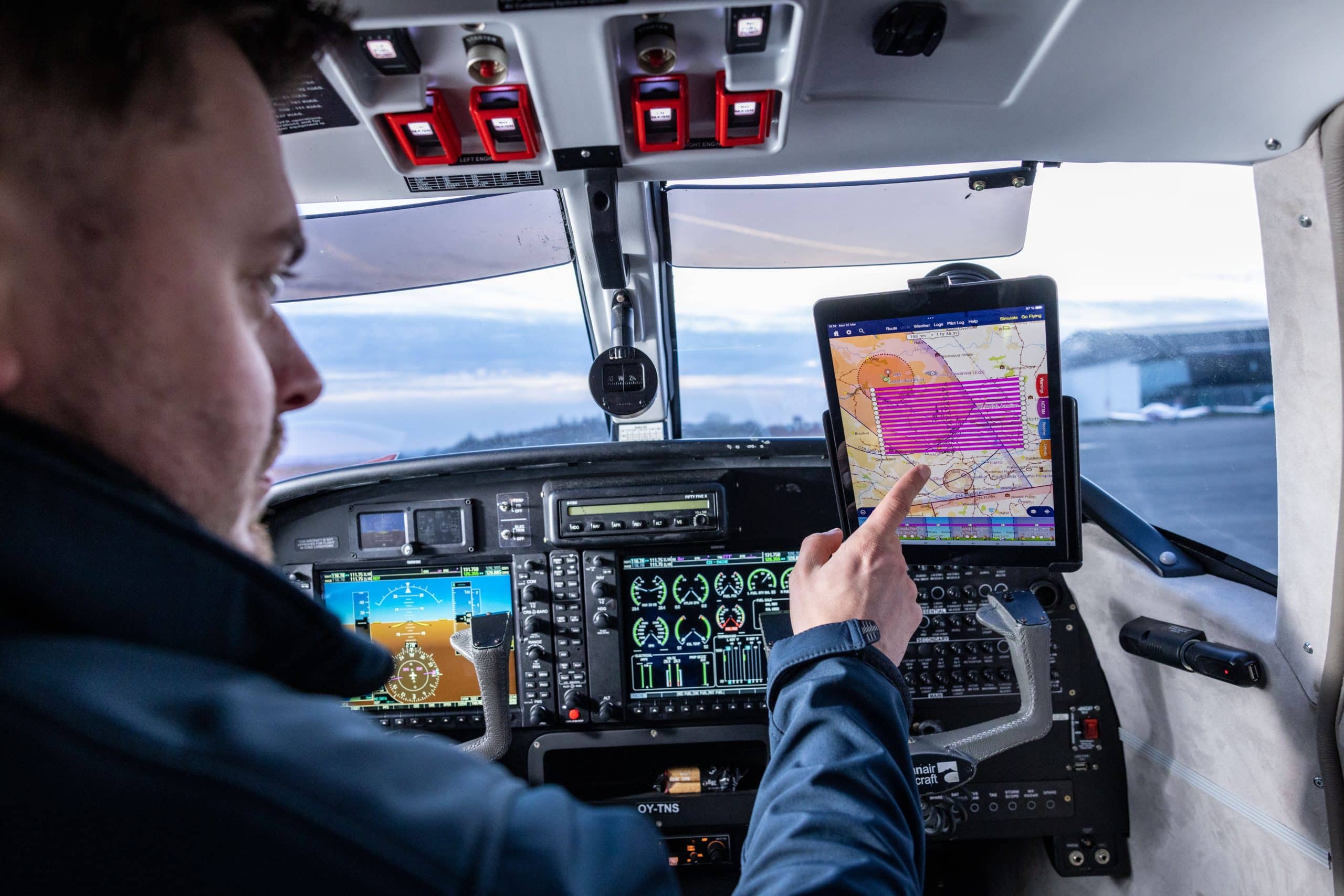
A pioneering space technology has been deployed for the first time in the UK to map heat loss from houses.
The test flight marked a significant step forward in the race to decarbonise UK housing stock with the deployment of cutting-edge space technology to identify buildings most in need of retrofitting action.
The specially equipped plane, mounted with a sophisticated thermal imaging camera, flew over Leeds to gather data on the level of heat loss from individual buildings. This aerial thermal imaging technique, developed by Satellite Vu, offers an unprecedented level of detail and scale, allowing local authorities to more effectively target funding for retrofitting homes by being able to identity the hottest buildings in the data set, those most in need of retrofitting and insulation.
The data collected will be used to identify priority areas for insulating homes, enabling a more efficient and effective allocation of resources to upgrade and decarbonise UK housing stock. The technology Satellite Vu are developing offers a game-changing solution as they will be able to aggregate areas of data and single out the leakiest buildings using an index spatial analysis.
The flight was funded by the net zero charity MCS Charitable Foundation and carried out in partnership with Leeds City Council. The council will use the thermal imaging data to help residents better understand heat loss and to motivate retrofitting in the private sector. The data will also be used to strengthen the case for local area-based retrofit and other schemes by the council that have already had a transformative impact, such as the recent whole house retrofit of 300 mixed-tenure Victorian back-to-back homes in the Holbeck area of the city.
The council’s efforts to improve the energy efficiency of homes in Leeds have yielded significant results. After updating Energy Performance Certificates (EPCs), it was found that each property on average saved 2.5 tonnes of CO2 per year. This translates to a total saving of 84 tonnes of carbon across the lifetime of each home, as well as a financial saving of around 25% or £350 per year. It is important to note that this was before the energy crisis, so fuel bills were around £1400 in these properties. If the same properties were retrofitted now, the savings could be as much as £700 or more due to the doubling of energy prices.
Dr Richard Hauxwell-Baldwin, Research and Campaigns Manager at MCS Charitable Foundation, said, “With 29 million homes in the UK urgently needing upgrades to be fit for the future, we need detailed data on building conditions on a massive scale. This proof of concept could provide that data for the first time and will be game-changing for investment in whole-street and whole-area retrofitting programmes.”
Natalia Kuniewicz, Sales Representative at Satellite Vu, said “We are thrilled to see the successful deployment of our aerial thermal imaging technology in Leeds, which represents a significant milestone towards our ultimate goal of mapping heat loss from individual buildings on a global scale. This pioneering technology has the potential to be a game-changer in the race to decarbonise housing stock, providing crucial data to local authorities to enable effective targeting of funding for retrofitting homes. We are excited to continue working with our partners at the MCS Charitable Foundation and Leeds City Council to further develop and roll out this technology across the UK and beyond.”
Notes
-
Images that capture the pilot flight taking off are available here: Satellite Vu Inaugural flight Leeds
-
Leeds City Council have developed a “priority neighbourhood” approach for retrofitting homes at scale, such as in the Holbeck area of the city: https://www.local.gov.uk/case-studies/retrofit-project-low-socio-economic-status-areas-leeds-city-council
About Satellite Vu
Founded to bring satellite technology to address global challenges, Satellite Vu will be able to monitor the temperature of any building on the planet in near real-time using a new mid-wave infrared camera. These images will provide valuable insights into economic activity, energy efficiency and disaster response, monitoring the energy efficiency of buildings, the spread of wildfires, the urban heat island effect, and water pollution. Satellite Vu aims to be the Earth’s thermometer from space.
Partnered with Surrey Satellite Technology Ltd to build the satellite constellation and with SpaceX for the first satellite launch in June 2023, Satellite Vu is bringing the highest resolution thermal data to enable us to see the world like never before and take critical action towards Net Zero goals.
Satellite Vu has recently opened its Early Access Programme, which provides customers and partners with preferred access to Satellite Vu’s imagery, products, and services; as well as the opportunity to secure capacity on the first thermal monitoring satellite. Prior to launch, customers will be able to influence ongoing aerial campaigns, as well as test integration with Satellite Vu’s delivery platform and APIs.
The MCS Foundation Media Office